|
If a large quake hit
Pugent Sound. . .
|
If a large quake hit
San Francisco. . .
|
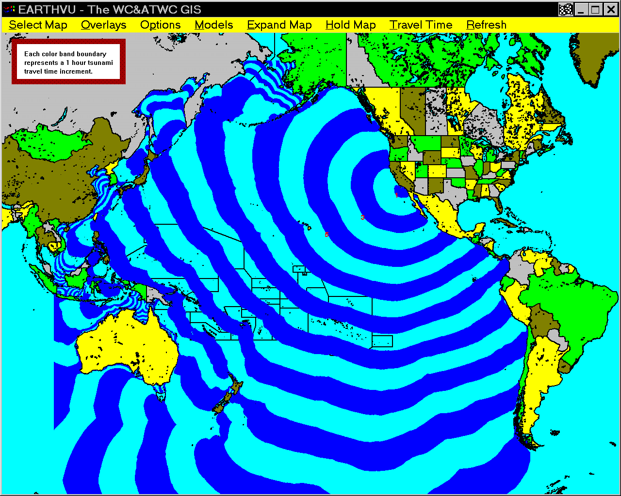
If a large quake hit
Los Angeles. . .
|
If a large quake hit
Cape Scott, Vancouver I., BC. . .
|
|
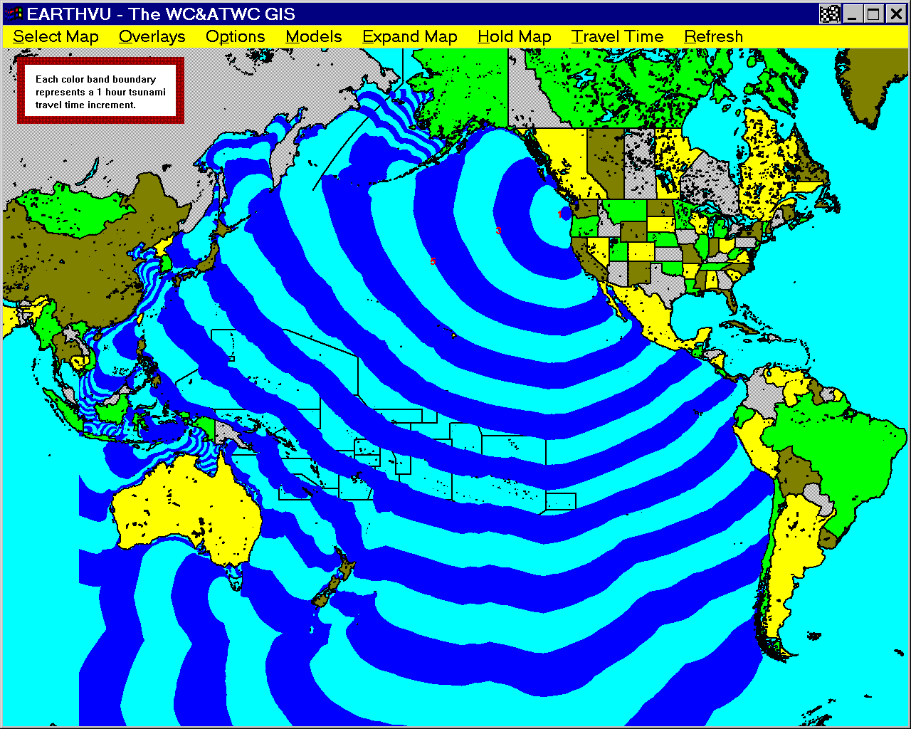
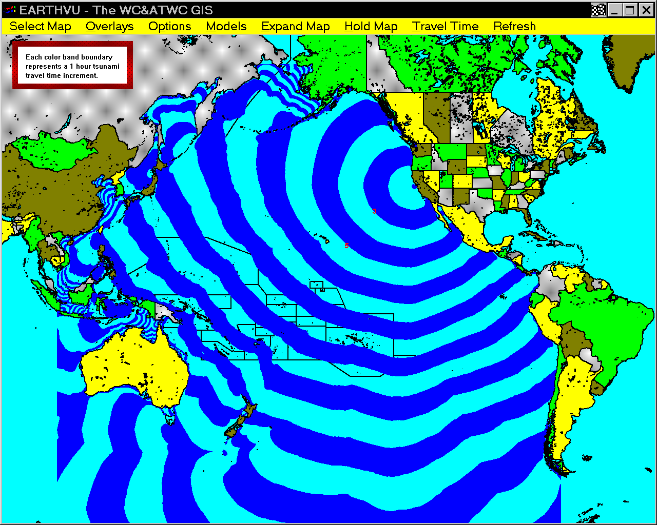
West Coast/Alaska Tsunami Warning Center Tsunami Travel Time Maps — Explanation
The following list links to 25 Pacific-wide tsunami travel time maps produced at the WC/ATWC. The maps show expected travel time from a source anywhere in the Pacific basin to coastal locations within the WC/ATWC AOR. A travel time map has also been included for the southeast coast of the big island in Hawaii. For example, map 2 shows the expected tsunami travel time from a tsunami source anywhere in the Pacific basin to Los Angeles, California. The contours are in 1 hour intervals. Each change in color of a contour line is a 1 hour mark. The travel time from the big Island of Los Angeles to Hawaii is about 5 hours 40 minutes in map 3.
Since tsunamis can be categorized as long waves, tsunami travel times can be computed with water depth as the sole variable (see, e.g., Murty, 1977). Long waves are those in which the distance between crests of the wave is much greater than the water depth through which the wave is travelling. Wave speed is computed from the square root of the quantity water depth times the acceleration of gravity. So, tsunami travel times can be computed without any knowledge of the tsunami's height, wavelength, etc. At the WC/ATWC, travel times are pre-computed for over 100 locations around the Pacific basin for all possible epicenter locations within the Pacific. Pre-computing these times helps decrease warning response time.
Travel times are computed on a finite grid with an increment of 15'x10'. This increment is appropriate for the open ocean, but is not fine enough for near-shore resolution. In the near-shore around the point of interest, finer grids of 1' or 12" increment are included within the Pacific-wide 15'x10' grid.
Due to source uplift size in an actual event, travel times shown on the maps may be in error up to 30 minutes. Source: NOAA http://wcatwc.arh.noaa.gov/main.htm
|